
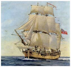
HMB Endeavour under full sail
|
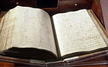
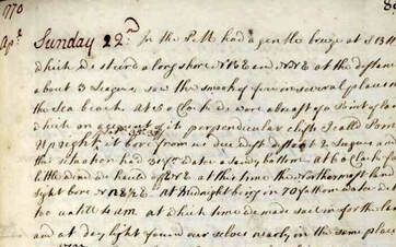
Captain James Cook's log book
|
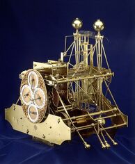
Harrison's first chronometer
|
First Sighting of the Great South Land
Cook wrote in his Journal on 31 March 1770 that Endeavour's voyage "must be allowed to have set aside the most, if not all, the Arguments and proofs that have been advanced by different Authors to prove that there must be a Southern Continent; I mean to the Northward of 40 degrees South, for what may lie to the Southward of that Latitude I know not".
His journal records his decision to set a course to return home via the yet unknown east coast of New Holland (as Australia was then called). His preference was to return via Cape Horn but that was not an option as the depth of winter will have set in at that lower latitude. He resolved to "return via the East Indies, sailing westward until they fell in with the East Coast of New Holland, and then to follow the direction of that Coast to the Northward ... until we arrive at its Northern extremity".
He set a course westwards, intending to strike for Van Diemen's Land (present-day Tasmania, sighted by Abel Tasman) to establish whether or not it formed part of the fabled southern continent. Prevailing gales forced them to maintain a more northerly course until land was sighted at Point Hicks on Thursday 19 April 1770 - recorded by this nautical date because Cook did not have the use of Harrison's chronometer to make the correct time adjustment. The date is now cited as Friday, 20 April.
Cook calculated that Van Diemen's Land ought to lie due south of their position, but having found the coastline trending to the south-west, he recorded that he doubted this landmass was connected to it. His expedition became the first recorded Europeans to have encountered its eastern coastline. The landmark is a point lying about half-way between the present-day towns of Orbost and Mallacoota on the south-eastern coast of the state of Victoria. A survey done in 1843 ignored or overlooked Cook's earlier record, naming it Cape Everard. On the 200th anniversary of the sighting, the name was officially changed back to Point Hicks.
Bass Strait
Cook had studied the old Dutch maps before leaving England and was fairly sure that Abel Tasman had found that this newly-found landmass is an island separated from the continental mainland by what is now Bass Strait. A talented and diligent hydrographer, Cook quickly surmised the likelihood of a strait. The Admiralty had issued its usual verbal instructions to hide strategically important discoveries that could become security risks, such as off-shore islands from which operations could be mounted by a hostile power.
Consequently, in his journal Cook disguised his discovery with a riddle; on his chart he drew a curtain across the truncated channel by sketching a false coastline down to an invented Point Hicks. If this is the accepted conclusion, then Cook's cartographic fabrication worked and Tasmania's island state was suppressed for three more decades.
Sources: https://en.wikipedia.org/wiki/First_voyage_of_James_Cook#Bass_Strait
Lying for the Admiralty Captain Cook's Endeavour Voyage by Margaret Cameron-Ash
Images from the Internet
© Arthur Phillip Chapter of Fellowship of First Fleeters 2021-
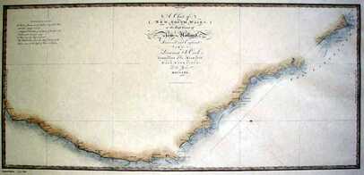
Antique version of Captain Cook's New South Wales on the Coast of New Holland (Australia c1770)
|
Page from Journal of HMB Endeavour, NLA
|
